
LET OP: Aankopen verlopen via de App Store, controleer daar altijd de meest actuele prijs, compatibiliteit en andere informatie. Je hebt een actief Apple account nodig om apps te installeren.
Weather4D Routing & Navigation integrates weather forecasting, routing calculations, navigation with digitized raster charts, instruments and data sharing to maximize your boating experience.
Navigation
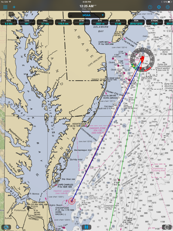
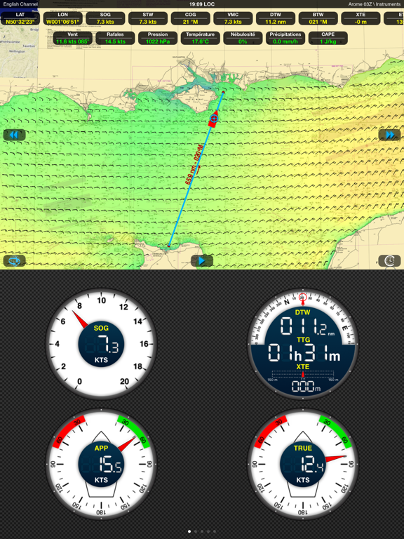
See SOG, COG, VMC, HDG, TWS, AWS, ETAs, ETWs, AIS data and more in real time along with weather and routing information with a wifi connection to a transponder.
Store your charts on your device for offshore/offline navigations.
Set the screen to night mode after sunset to better see what’s happening outside during your watch.
Set alarms to alert about excessive XTE, course deviations, surrounding boats, excessive wind speed and low depth.
Take advantage of the iPad/iPhone built in compass, pressure and acceleration sensors.
Connect bluetooth devices like wireless anemometers and wind vanes.
Share AIS and boat sensors data like wind, current, pressure, air and sea temperature within the Weather4D users community.
Activate Man Overboard safety feature to estimate drift and thus rescue location based on current and wind.
Weather
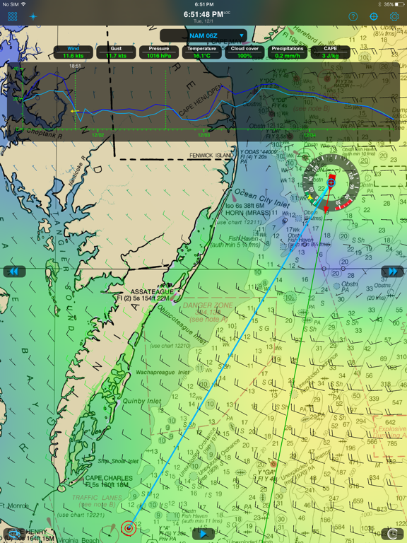
View combined weather data displayed in 3D HD layers animated automatically or manually by sliding a finger on the screen.
Use GFS model to get started. In addition, over 35 weather and oceanographic models are available with a yearly subscription (in-app purchase).
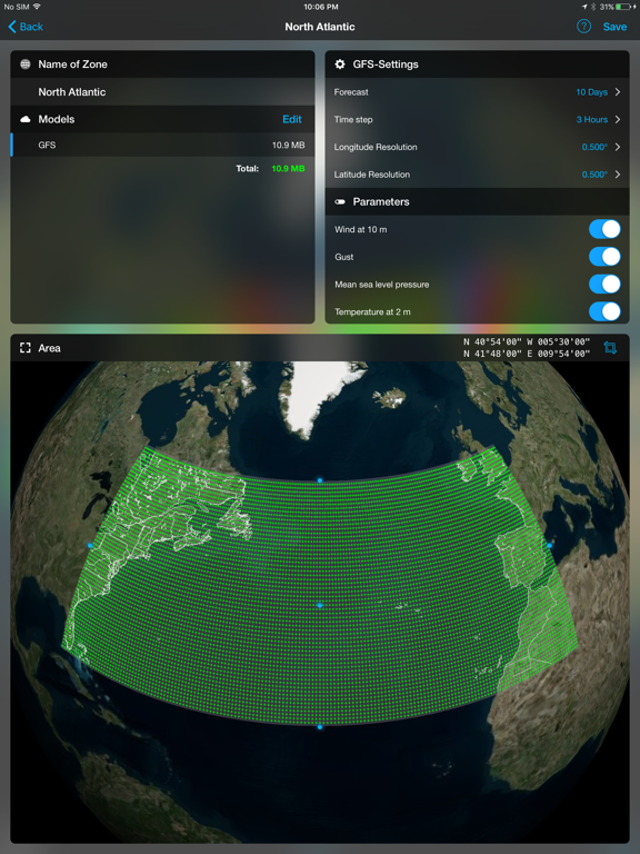
Create your own geographical zones, select the models you need and download only the characteristics that matter to you: data type, resolution, periodicity, file size, etc. GRIB files can be downloaded anywhere through a regular or satellite internet connection.
Split the screen (iPad only) to combine and/or compare: navigation and weather, weather and waves or currents, two weather models…
Routing
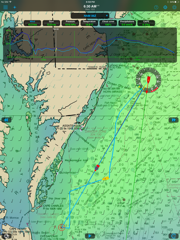
Routing calculation optimizes for safety, comfort and performance when sailing, motoring, or mixing the two.
Create a route and calculate its associated routings in function of departure dates/times, forecasts (weather, wave and current), minimum sailing speed, motoring speed, boat polar, maximum wind and minimum distance to the coast.
Visualize sail configurations based on your routings and your own set of sails.
Save waypoints, locations, simulate routes, combine them with GRIB forecast models.
Restart a routing calculation at anytime from the actual boat position.
Default Models and Charts
————————————
GFS global forecast model at 0.25 °, 0.5 °, 1 ° and 2 ° resolutions
BING global chart
OSM (Opens Street Map) global chart
Optional Models (GRIBs) and Nautical Charts (additional fees apply)
——————————————————————————————-
ECMWF IFS & AIFS
NAM USA
HRR CONUS
GDPS
ICON-EU Europe
ICON D2
UKV
ARPEGE Global, Europe
AROME France, Antilles, Guyane, Polynésie, Calédonie, Indien
AROME HD France
Waves:
GFS Wave
MFWAM Global, Europe, France
IFREMER
Currents:
Copernicus Global SMOC, IBI, NWS, Baltic, Med
NCOM AMSEAS, USEAST, ALASKA, SOCAL, HAWAII
HYCOM
IFREMER
MSC Saint Laurent
Nautical Charts:
GeoGarage is Weather4D supplier and offers by subscription access to more than 10,000 nautical charts derived from International Hydrographic Services. Pricing and chart selection is set per publisher. Updates are released regularly under chart publishers authority. Once the subscription is purchased, charts are instantly accessible within the application.
Available publishers:
NOAA RNCs (USA)
CHS (Canada)
WAVEYLINE (Bahamas)
DHNV (Venezuela)
DHN (Brazil)
SHN (Argentina)
LINZ (New Zealand)
SHOM (France / DOM-TOM / Polynesia + international)
UKHO (UK and dependencies + international)
BSH (Germany)
NLHO (Netherlands)
VLAAMSE (Belgium)
DGA (Denmark)
NHS (Norway)
ICG-HD (Iceland)
NAVIMAP / IIM (Italy)
ENC_ES (Spain)
ENC_HR (Croatia)
ENC_PL (Poland)
ENC_PT (Portugal)
ENC_AU (Australia)
BLP (West Mexico)
IMRAY (North Sea, English Channel, West Britain & Ireland, Atlantic France, Iberia & Atlantic Islands, Western Mediterranean, Central Mediterranean, East Mediterranean, Netherlands)
GeoCuba (Cuba)
--
Weather4D Routing & Navigation van APP4NAV is een app voor iPhone, iPad en iPod touch met iOS versie 13.0 of hoger, geschikt bevonden voor gebruikers met leeftijden vanaf 4 jaar.
Informatie voor Weather4D Routing & Navigationis het laatst vergeleken op 15 Sep om 18:14.
Informatie
- Releasedatum:9 Dec 2015
- Bijgewerkt:4 Jul 2026
- Versie:2.0.95
- Compatibiliteit:Vereist iOS 13.0 of nieuwer. Compatibel met iPhone, iPad en iPod touch.
- Grootte:543 MB
- Leeftijd:4+ jaar
- Beoordeling:4 van 5
- Categorie:
Nieuw in versie 2.0.95
• Updated to the WMM 2025 World Magnetic Model.
Prijsgeschiedenis
Meer van APP4NAV

Reageer op deze app
Dit vind je misschien ook leuk
Laatste reacties
- Jo zei over Word Domination: "Leuke ap enkel wel heel jammer als je een nieuwe booster wilt..."
- Marc Van Hoey zei over Belfius Mobile: "beste, iPadgebruik, na laatste update, app. belfius mobile,..."
- Sanne zei over GoWish: "Ik heb deze eerst gebruikt, maar toch wel erg Amerikaans.. Ik..."
- Frederik Visser zei over Talkie: Tekst naar Spraak: "Ik ben op zoek naar ervaringen van gebruikers van de pro..."
- Frederik Visser zei over Talkie: Tekst naar Spraak: "Ik ben op zoek naar ervaringen van gebruikers van de pro..."
- Mario van Gool zei over Vue NL: "1 groot drama. Account van mijn zoon niet meer in te loggen...."
- Thijs zei over Burgernet: "Bij het openen van de app komt het bericht ""Er is iets..."
- Barry zei over Klaverjas: "Ik speel met vrienden tegenwoordig op de app ‘Klaverjas..."
- Catharina zei over DVHN - Nieuws & Digitale Krant: "Ik mis het nieuwswoord. Kunnen jullie dit weer toevoegen? Het..."