LET OP: Aankopen verlopen via de App Store, controleer daar altijd de meest actuele prijs, compatibiliteit en andere informatie. Je hebt een actief Apple account nodig om apps te installeren.
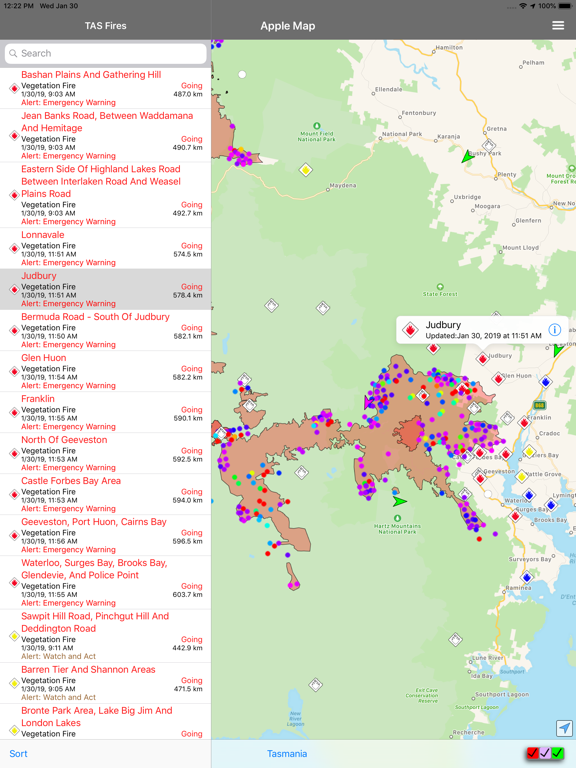
This is the original TAS Fires app and is designed to provide up to date information about bush fire data in Tasmania, Australia for iPhone, iPad and iPod users.
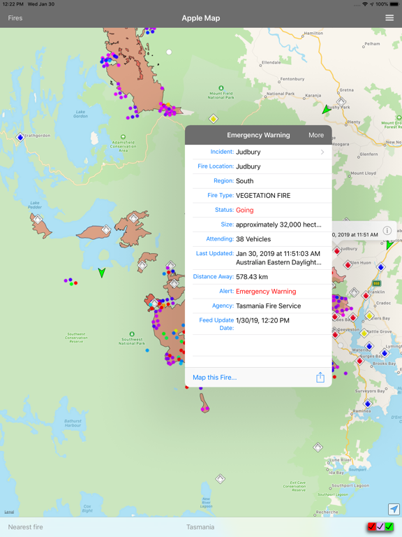
The information is provided to you in both a searchable/sortable list and on a map to help the user understand which fires are of importance to them. The information can also be shared via social media/email and text.
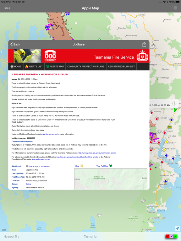
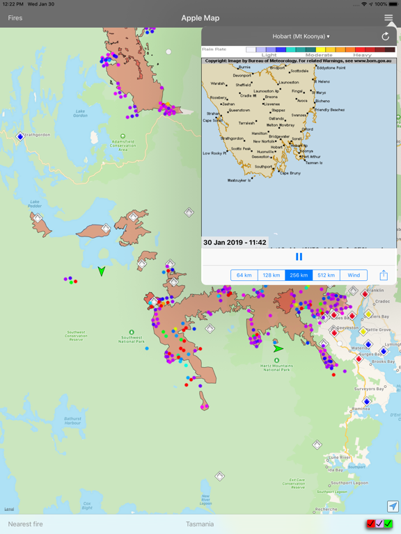
It utilises data from the Tasmanian Fire Service RSS feeds on fires, wind data from the Bureau of Meteorology with your current location provided by the iPhone GPS.
Using this information the application is able to provide a list of fires showing the nearest ones first, helping you to understand your current situation.
The information is reliant on both the accuracy of the iPhone GPS and the data recorded on the TFS's website.
This application does not cache any data, so Internet access (either Wireless. 3G or LTE) is required to access the data.
Be aware that while P4G has utilised "best efforts" to provide this information to you, it is not intended to replace other sources of information on the fire situation near you. Also remember that fire and weather can change quickly.
All data is provided Copyright from the Tasmanian Fire Service and the Bureau of Meteorology.
Follow P4G on twitter at P4G_Apps
--
TAS Fires van P4G Pty Ltd is een app voor iPhone, iPad en iPod touch met iOS versie 13.0 of hoger, geschikt bevonden voor gebruikers met leeftijden vanaf 4 jaar.
Informatie voor TAS Firesis het laatst vergeleken op 28 Jul om 15:42.