
LET OP: Downloads verlopen via de App Store, controleer daar altijd de meest actuele prijs, compatibiliteit en andere informatie. Je hebt een actief Apple account nodig om apps te installeren.
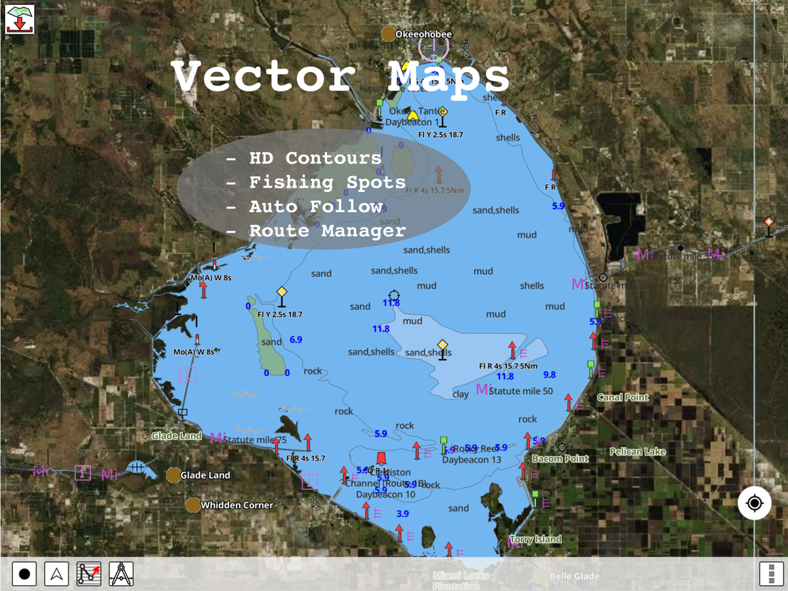
Only app with Fishing AI to find productive fishing breaklines and fishing spots. It offers access to Fishing Lake Depth Maps & Marine Charts with fishing points for USA, Canada, UK, etc. Coverage includes NOAA marine vector charts,freshwater lake maps,USACE inland river maps (HD/1ft bathymetry/Sonar Contours).
First Fishing GPS app to have route assistance with Voice Prompts for marine navigation. You can create new boating routes or import existing GPX/KML routes. It supports Nautical Charts course up orientation. Includes Tide & Currents prediction.
► FISHING AI
Emulates an expert angler. It is trained to include multiple variables.
√ Lake bathymetry/topography
* Point Bars
* Humps / Underwater Islands
* Channels
* Saddles
* Artificial / Man Made Structures
* River Bed
* Ledges
* Side Feeder Streams
* Pits
* And more...
√ Local Knowledge for a lake gained over the years about likely hot spots
√ Weather Patterns
√ Vegetation Maps
√ Fish Type
►FEATURES
√ Beautiful & detailed Hardware/GPU accelerated vector charts (text stays upright on rotation)
√ Long press to query the details of Marine object (Buoy,Lights,Obstruction etc).
√ Customizable depth(Ft/Fathom/Meter) & distance units(km/mi/NM)
√ Customizable Shallow Depth.
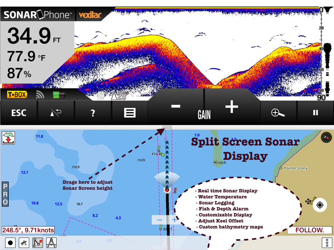
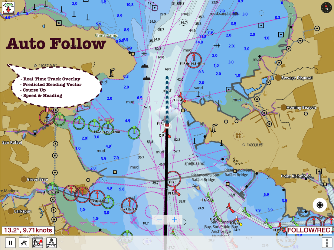
√ Record tracks,Autofollow with real-time track overlay & predicted path vector.
√ Voice Prompts for marine navigation (requires GPS )
√ 1ft / 3ft depth contour maps for anglers for selected lake maps.
√ Supports GPX/KML for boating route editing/import.
√ Tide & Currents prediction.
√ Seamless chart quilting of marine charts
√ Enter or import Waypoints.
► MAPS
It includes unlimited updates for 1 year.
√ Lake Maps & Nautical Charts with Fishing Points covering US, UK,Germany, NL, AU etc.
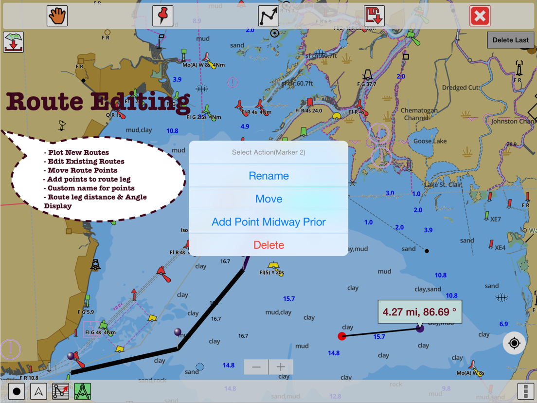
►ROUTE MANAGEMENT / TRIP PLANNING
√ Create New Route/Edit Existing Routes
√ Move Points
√ Add points to an existing route leg
√ Delete / Rename points
√ Import GPX,KML & KMZ files
√ Plot/Edit Routes
√ Enter Waypoints
√ Share/Export Routes,Tracks&Markers
√ Reverse Routes
►GPS FEATURES
√ Auto Follow
* Real Time Track Overlay
* Predicted Path Vector
* Course Up(Text stays upright)
* Speed & Heading
√ Route Assistance With Voice Prompts
* Prompts when approaching a boating route marker
* Continous distance & ETA updates
* Alerts when sailing/boating off route
* Alerts when boating in wrong direction
√ Record Tracks
►TIDE & CURRENTS
* For US, Canada, UK, Germany & New Zealand
* High/Low Tides
* Tidal Current Prediction
* Active Current Stations
► SHARING
* Share tracks/routes/markers on Facebook & Twitter
* Export tracks/routes/markers as compressed GPX files.
Sample Charts
√ KISSIMMEE, Lake Apopka, ISTOKPOGA, SEMINOLE, TOHOPEKALIGA, Lake Tohopekaliga, HARRIS, Lakeocklawaha,
√ East Lake Tohopekaliga, Bighenderson, GRIFFIN, MONROE, TALQUIN, Lake Eustis, EUSTIS, WEOHYAKAPKA,
√ ORANGE , HARNEY, MICCOSUKEE, HATCHINEHA, SANTA FE SWAMP, Farm 13 Stick Marsh, Weir,
√ LOCHLOOSA , Crooked Lake, MARIAN, DEER POINT , HANCOCK, ROSALIE,
√ DORA, POINSETT, CROOKED , SANTA FE , RIVER STYX, Lake Yale,
√ YALE, CYPRESS , Lake Louisa, KERR, ARBUCKLE, PIERCE, June, JACKSON, PANASOFFKEE,
√ ALLIGATOR , DOCTORS , REEDY , OKAHUMPKA SWAMP, Jackson, Forest North, ROUSSEAU, MARION,
√ WASHINGTON, JOHNS , TARPON, Lake Minnehaha, HAMILTON, WOODRUFF, TIGER ,
√ DEXTER, PARKER, SAMPSON, COBB MARSH, Lake Minneola, GENTRY, DORR, BUTLER, Kingsley,
√ WINDER, TRAFFORD, BUFFUM, Josephine, TIBET, CLINCH, OKAHUMPKA,
√ LITTLE SANTA FE , ELOISE, Cherry Lake, BEAUCLAIR, MATTIE, CONWAY, SOUTH ,
√ OTTER SLOUGH, Bigsand, ASHBY, ARIANA, Hampton, CYPRESS CREEK, JULIANA, ,
PLEASE NOTE: Continued use of GPS running in the background can dramatically decrease battery life.
Terms of Use:
https://www.apple.com/legal/internet-services/itunes/dev/stdeula/
--
Fishing Points-Lake Depth Maps van Bist LLC is een app voor iPhone, iPad en iPod touch met iOS versie 15.6 of hoger, geschikt bevonden voor gebruikers met leeftijden vanaf 4 jaar.
Informatie voor Fishing Points-Lake Depth Mapsis het laatst vergeleken op 6 Oct om 02:16.




Informatie
- Releasedatum:7 Mar 2017
- Bijgewerkt:29 Sep 2026
- Versie:166.0.0
- Compatibiliteit:Vereist iOS 15.6 of nieuwer. Compatibel met iPhone, iPad en iPod touch.
- Grootte:51.9 MB
- Leeftijd:4+ jaar
- Beoordeling:5 van 5
- Categorie:
Nieuw in versie 166.0.0
- Older iOS devices compatibility update
- Compiled with latest version of Xcode.
Meer van Bist LLC

Reageer op deze app
Dit vind je misschien ook leuk
Laatste reacties
- Ryan zei over James-Horeca: "Zeer teleurstellende ervaring Helaas heb ik een erg negatieve..."
- Ro Rare zei over myOpel: "LoL dat een company als Opel zo'n slecht functionerende..."
- Jo zei over Word Domination: "Leuke ap enkel wel heel jammer als je een nieuwe booster wilt..."
- Marc Van Hoey zei over Belfius Mobile: "beste, iPadgebruik, na laatste update, app. belfius mobile,..."
- Sanne zei over GoWish: "Ik heb deze eerst gebruikt, maar toch wel erg Amerikaans.. Ik..."
- Frederik Visser zei over Talkie: Tekst naar Spraak: "Ik ben op zoek naar ervaringen van gebruikers van de pro..."
- Frederik Visser zei over Talkie: Tekst naar Spraak: "Ik ben op zoek naar ervaringen van gebruikers van de pro..."
- Mario van Gool zei over Vue NL: "1 groot drama. Account van mijn zoon niet meer in te loggen...."
- Thijs zei over Burgernet: "Bij het openen van de app komt het bericht ""Er is iets..."