NV Charts GPS Navigation AIS
NV Chart Group GmbH
LET OP: Downloads verlopen via de App Store, bekijk daar altijd de meest actuele prijs, compatibiliteit en andere informatie. Je hebt een actief Apple account nodig om apps te installeren.
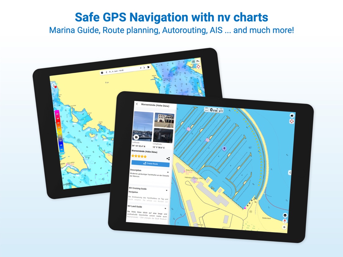
A clearly structured navigation app with intuitive and comprehensive tools for navigation on board. All current editions of the boating charts or maps from NV Verlag / NV Charts can be easily downloaded and used for offline navigation with the NV Charts App. All latest editions of NV Charts nautical boating charts or inland charts including | North Sea | Baltic Sea | Netherlands | Wadden Sea | IJsselmeer | Sweden | Denmark | Germany | Norway | France | USA | Caribbean | Bahamas areas are compatible with NV Charts App.
One way to have great nautical charts both on paper and on our phone or tablet is to use our popular combination pack of paper and digital nautical charts, which includes both charts in clever atlas format and a license for digital nautical marine boating charts/maps for use in the NV Charts App, including an update service. The advantage: Both your paper and digital charts are up to date.
In addition you can also purchase digital boating charts as a subscription directly in the NV Charts App. The subscription duration is one year and is automatically extended.
If it is not yet clear where the journey is going to take you, free online charts can be displayed in the app, even without a current subscription or valid paperchart edition.
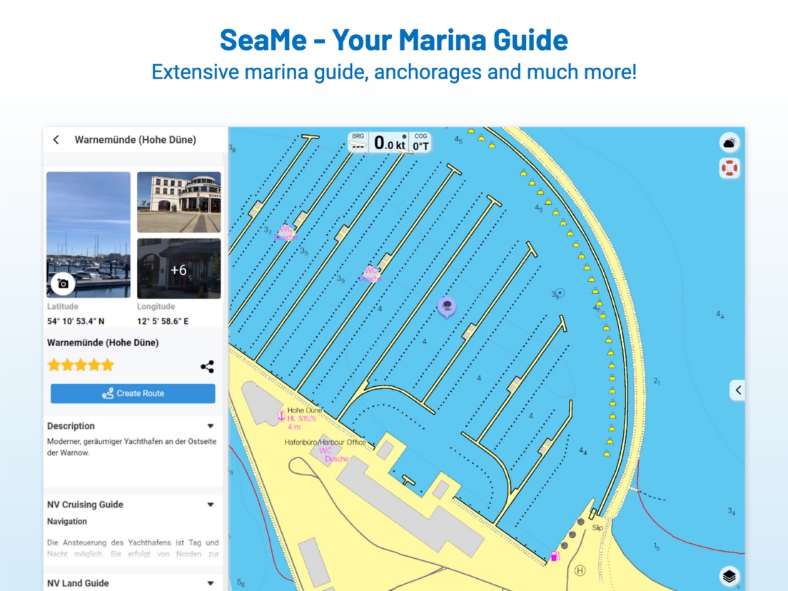
The latest information is essential for safe navigation on the water. With the NV Charts App you have the possibility to become part of the Seame boating community. You can now add marinas, anchorages and navigation warnings to the digital chart and also add and share interesting places beyond navigation, such as restaurants or points of interest with pictures. Others can respond directly with comments. The continuously edited content can be downloaded directly to be available offline. In order to make all information easily accessible, we have improved the search function: You can explore the surroundings and search directly for place names as well as anchorages, harbours, ramps, waypoints, cranes, petrol stations, or tide stations. In addition, an auto-routing function has been integrated, which allows you to navigate directly to your destination.
Together navigation on board is even more fun! You can now share your tracks with friends or use the data outside the app and export it as GPX file. You can share your favorite harbours and anchorages from the app simply by clicking on a link and coordinate your trip planning even better with everyone.
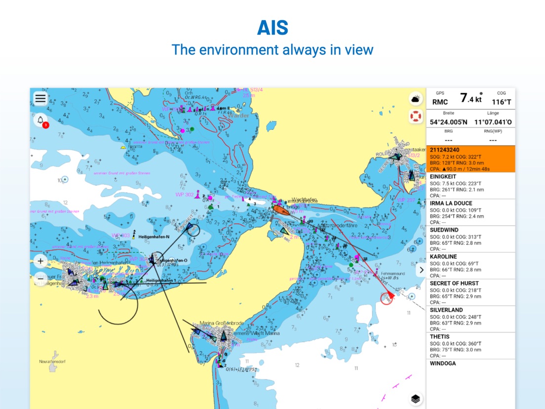
With the AIS function in the NV Charts App you can keep an eye on AIS signals in real-time. You can connect a Wlan AIS receiver to the NV Charts and the app display AIS Class A and B signals and navigation aids (ATON), as well as MOB AIS SART transponder distress transmitters, directly in the digital chart in real-time and the traffic situation can be assessed better.
The NV Charts App can be installed and synchronized on multiple devices.
NV Charts App - Features:
+ Search function
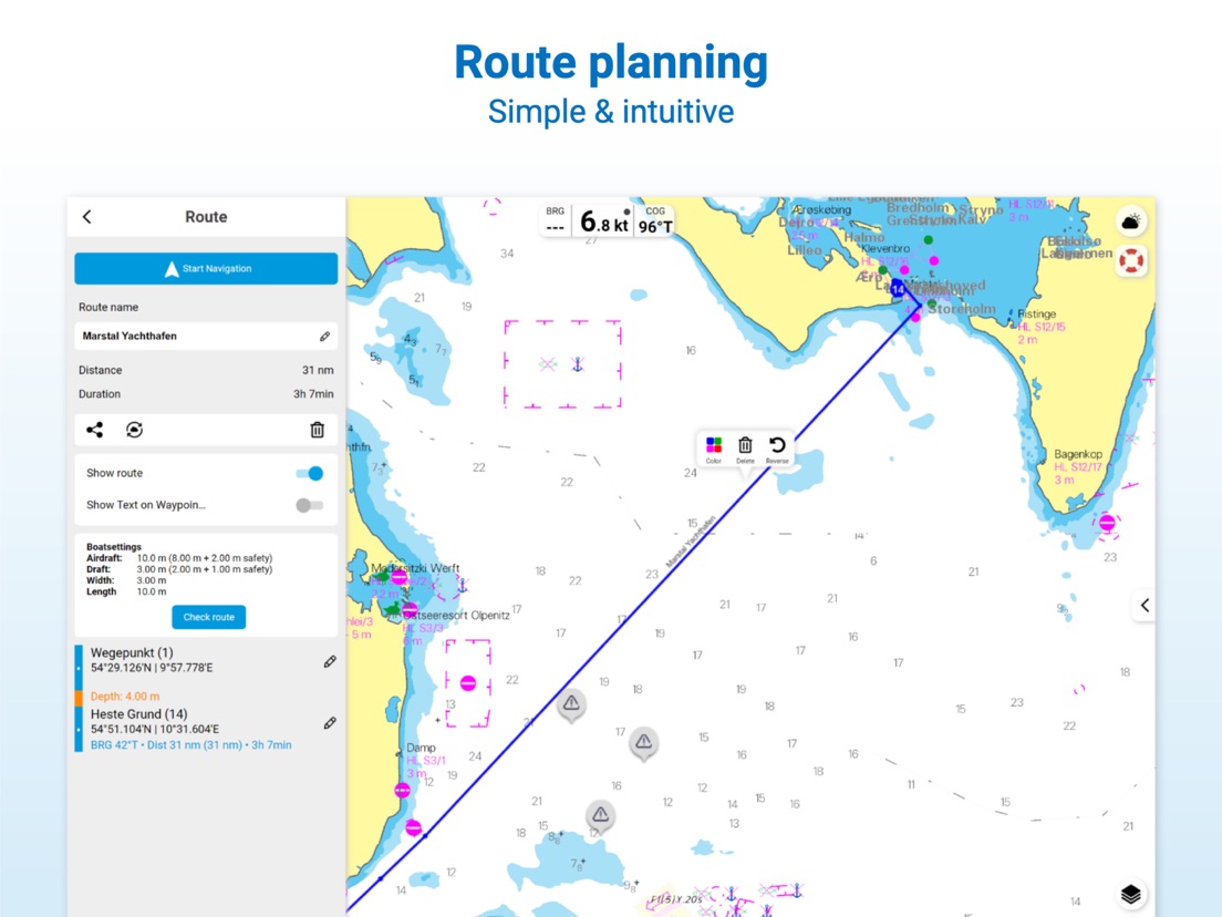
+ Autorouting (Europe + other regions following soon)
+ Velocity Made Good (VMG)
+ Community Layer / Points of Interest(POI)
+ Free online boating charts preview for planning
+ In App Purchases of digital offline charts
+ Community Layer / Points of Interest(POI)
+ Reads all NV Chart chart areas
+ Easy download of the maps
+ Always the latest data
+ Seamless zoom and panning functions
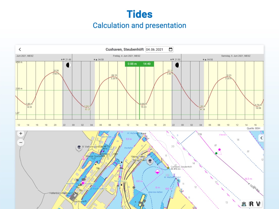
+ Tide Forecast
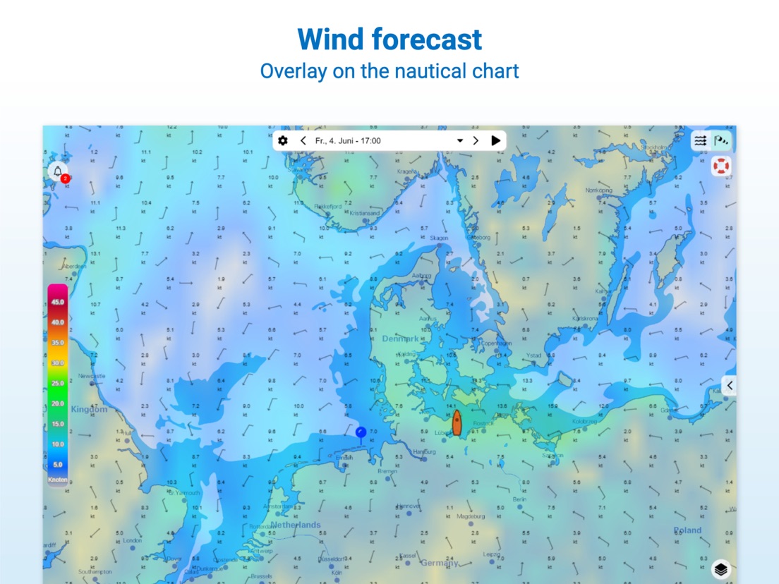
+ Online weather
+ AIS Wifi Support
+ AIS Sart Beacon
+ AIS CPA function
+ Night mode
+ Anchor alarm
+ Position with GPS
+ Intuitive route planning
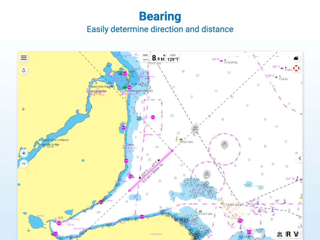
+ Course markings, markings, bearing ruler
+ Port information
+ Display of instruments
+ Synchronizing devices
+ Live Position Sharing
+ Social sharing of routes, tracks, positions
Note:
Continued use of GPS in the background can significantly reduce battery life.
--
NV Charts GPS Navigation AIS van NV Chart Group GmbH is een app voor iPhone, iPad en iPod touch met iOS versie 15.6 of hoger, geschikt bevonden voor gebruikers met leeftijden vanaf 4 jaar.
Informatie voor NV Charts GPS Navigation AISis het laatst vergeleken op 2 May om 18:53.

Informatie
- Releasedatum:17 Jun 2013
- Bijgewerkt:2 May 2024
- Versie:2.730.224
- Compatibiliteit:Vereist iOS 15.6 of nieuwer. Compatibel met iPhone, iPad en iPod touch.
- Grootte:78.6 MB
- Leeftijd:4+ jaar
- Beoordeling:4.2 van 5
- Categorie:
Nieuw in versie 2.730.224
Performance Improvements:
# Optimized compatibility for various iOS devices and versions
# Improved app speed and stability
# Parallel processing mode improvement
Updated Chart Presentation:
# Enhanced NV Charts Vector Chart Engine V4
> Optimized text placement in vector maps
> Improved colour design vector chart rendering
> Improved night mode vector chart rendering
> Improved depth units setting
> Improved display of drying depth values
> Improved safety contour and safety depth
> Improved chart frame display
> Screenshot function with optimized chart rendering
> Extended presentation library for inland waters
> Initial base map available directly after installation
New Features and Improvements:
# Improved AIS CPA warning
# New AIS CPA audio warning tone
# Improved AIS night display
# Improved display of AIS information
# Improved anchor alarm and warning sound + iOS: Critical alerts
# New folder structure for routes and markers
# Improved search for coordinates
# Improved chart rotation
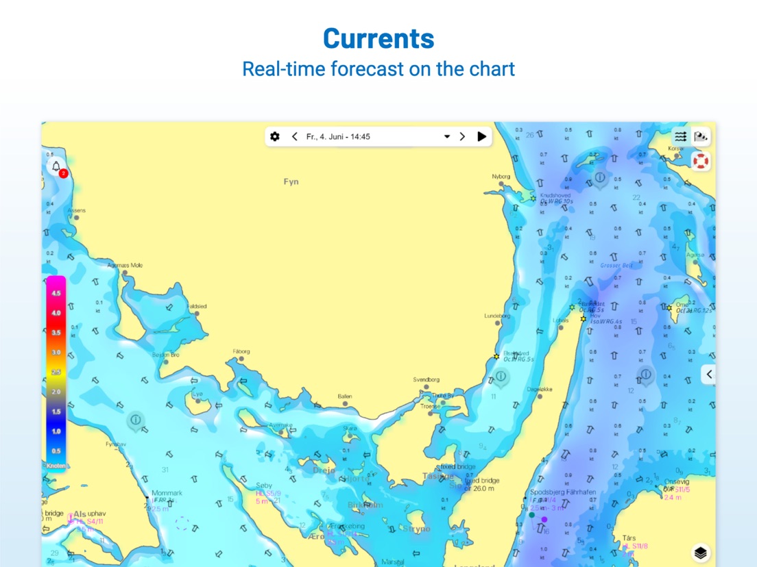
# New offline availability of wind and current data
# Improved wind and current menu
# Improvement wind unit Bft
# Improvement of tidal curves for the whole year
# New support of true or magnetic heading sensor support
# Improvement GPS heading stabilization
# Improvement empty COG values NMEA
User Interface and Usability Enhancements:
# Help texts in the menu
# Night mode at layer button
# Improved profile image display
# Improved profile synchronization
# Improved colour design of routes, markers
# Improved orientation of images to markers
# Improvement hint and tips memory usage popup
# New in app function to delete user account
23 geschreven reviewsRecensies
Vastloper
MeerOn iPad Air 4th Gen the app gets stuck regularly and has te be restarted. Also some issues with raster resolution. Otherwise fine, good automatic navigation functionality
3door Jer*****08/10/2023Alleen voor nieuwe gebruikers
MeerAls hij het doet is het een fijne app. Kaarten toevoegen aan de app die je onderweg koopt bij een watersportzaak kan niet. Deze service is niet beschikbaar in de app.
2door M B*******04/08/2023App werkt niet, laat geen online kaarten zien
MeerGeen online kaarten en de aangeschafte kaarten zijn na 1 jaar niet meer te gebruiken, je koopt een licentie voor 1 jaar.
2door Wad*****10/08/2022
Reageer op deze app
Dit vind je misschien ook leuk

Laatste reacties
- Arie V. zei over Intergas Comfort Touch: "Nieuwste versie is niet beter maar eerder slechter geworden...."
- Yentl zei over Podimo: Podcasts Luisterboeken: "Normaal echt zo’n fan, maar hij blijft nu maar stoppen. Echt..."
- Peter zei over PMT: "Werkt PMT samen met windows 11"
- Tom Brandt zei over Fitbit: gezondheid en fitness: "Naar aanleiding van uitgebreid onderzoek op..."
- Esther Visschers zei over Dice Dreams™: "Jammer dat er niet meer mogenlijkheden zijn om te kunnen..."
- Ilona zei over Ruzzle: "De laatste weken hapert Ruzzle heel erg. Het pakt de woorden..."
- Hkling zei over ANWB Energie: "De tussenstand wordt vanaf januari niet meer bijgewerkt...."
- Margot zei over Ruzzle: "Ik heb pas weer een update van Ruzzle gehad en sindsdien werkt..."
- Luc Vanborm zei over Ticketmatic: "Bij het updaten van de nieuwe app, zijn de nog niet verlopen..."